Wupatki Pueblo Landscape Assessment
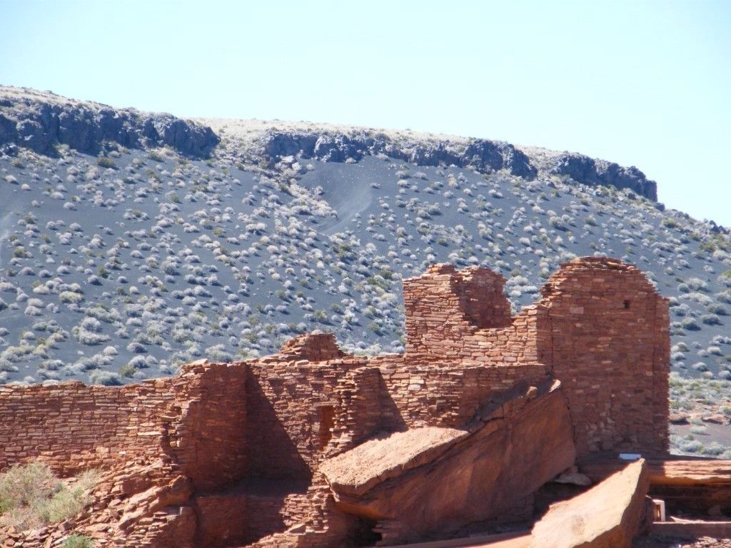
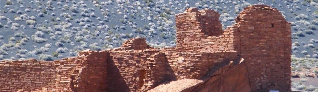
Wupatki Pueblo is a Sinagua culture Ancestral Puebloan community that was occupied between the late A.D. 1000s and early 1200s. Wupatki Pueblo is the centerpiece of Wupatki National Monument, in northern Arizona, northeast of Flagstaff. As many as 100 rooms may have been constructed at the peak of occupation, as well as an unroofed circular public space (the “community room”), a ball court, and numerous minor features. MNA is collaborating with NPS on a project to define and assess the geological, seismic and hydrological threats potentially confronting Wupatki Pueblo.
The first phase of the project entailed intensive archaeological inventory within the area surrounding Wupatki Pueblo and detailed documentation of all the cultural features within that area. The survey identified seven isolated features or artifacts, as well as 95 features associated with separate 18 archaeological sites, 13 of which were previously recorded to some degree. With overlapping site boundaries and small distances between features, the traditional concept of “archaeological site” is meaningless in this area, and reflects the intensive nature of the occupation.
The dramatic landscape that characterizes Wupatki National Monument was shaped by tectonic, volcanic, and erosional forces. Earthquakes are not uncommon to northern Arizona, and the most recent volcanic eruption was only about 900 years ago. Although the likelihood of a major earthquake or volcanic eruption remains small, this project is compiling the most recent data to better assess the potential risks to Wupatki Pueblo.
Erosion is an ongoing and persistent force that created the impressive landscape, but also contributes to the loss of cultural resources. The main pueblo sits on an erosional ridge and huge blocks of dislodged sandstone. The now-open rooms are susceptible to rainfall erosion that weakens the walls and erodes the foundations.
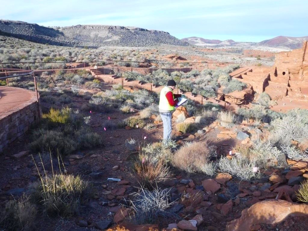
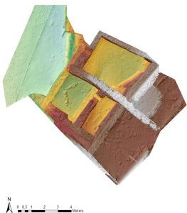 The second phase of this project involves mapping the types of geomorphic deposits on a micro-scale to better identify and understand the processes that have detrimental impacts on the walls and floors. Teaming up with colleagues and students from Northern Arizona University, we are using 3D structure-from-motion technology and GIS to map the erosional and depositional patterns on the floors of several rooms, allowing us to predict what rainfall events might produce the worst erosion, for example.
As part of this study, MNA is also mapping and measuring properties of the newly recorded cultural features surrounding the pueblo that are in soft surficial sediments. These features are eroding by rilling and gullying. Recording, measuring, and understanding erosional processes in the Wupatki Cultural Landscape will help cultural resource managers preserve this unique archaeological site.